Moc pěkný příspěvek, osobně ke stejnému účelu používám v mobilu aplikaci RMaps, ale vždy jsem stahoval pouze malé výřezy. Takže děkuji za to XML. 
Jinak pokud někomu nevadí nutnost stahovat mapy z internetu tak 2.voj.map. je k dispozici přes aplikaci Mapy od Seznamu.
How to get an offline map on your phone and use your phone as a GPS
Categories: Maps and GPS
When my last classic phone died and I replaced it with a new "smart" one, I was immediately interested in the possibility of using it as a GPS.
I tried every possible program I could find. Most wanted an online connection, so I paid for internet and tried further. Eventually I found out that this was not the way to go. The connection was (and is) poor quality, slow and relatively expensive, plus it tends to drop out at the exact moment you need it most. Although with apologies to the operators - where we like to go most (forest, creek cuts, roads ...) the sun doesn't even shine, let alone any signal from the transmitter.
I started looking for a combination of software and offline maps. In the end I stuck with Locus and I make my base maps in MOBAC (MOBile Atlas Creator). As a basis for fast and reliable orientation, I use a vector map that can be downloaded under the name czech-republic-20120218.map It is fast and, as I have verified, quite accurate. So far, it hasn't let me down, and I use it as a GPS when travelling around the Czech Republic - so far it hasn't driven me anywhere in the field like the latest map from the unnamed branded GPS manufacturer that I have in my car.
There is no point in describing both programs here, there are extensive discussions and tutorials on the internet.
Instructions for making a map in MOBAC for Locus can be found here: http://www.geocaching.cz/forum/viewthread.php?forum_id=7&thread_id=21539
Right at the top of the page you have a link to download the MOBAC program, including downloads of many of the underlying maps (including orthomaps and tourist maps), which I hope everyone can choose from. What I didn't find there are the maps we are interested in - the II and III military mapping and the historical orthophotomap from Cenie.
So I'll take the liberty of describing one way to get these maps offline on your mobile. I'm not a professional cartographer, nor a programmer, nor any kind of mobile app expert. Maybe someone has a better or simpler approach, but I've tried this and it works.
What we need:
1. A "smart mobile phone" with GPS and Android
2. MOBAC
3. Locus
4.A computer with an internet connection
5. Time and patience
Adding a map source to MOBAC - II and III military mapping.
Programmers and people otherwise knowledgeable can write their own xml code to attach the WMS layer. The rest of us pick some ready-made code (from the mapsources directory), and get to editing by trial and error. When the map we want appears in MOBAC, we can start making the map.
Just a technical note - Locus is said to work poorly with a map that is more than 2 GB in size. So it is better to make more maps in smaller units, it is probably not worth trying to make the whole Czech Republic in zoom 16. For information and idea - South Bohemia region, III Military, zoom 8-15 has about 1GB and the map took about four hours to create in MOBAC.
I managed to make the following connections for the II and III military mapping.
Simply copy the code into notepad (or another text editor that saves it as plain text) and save it under the selected name with the xml extension in the mapsources folder of MOBAC. The program must not be running. After copying and running the program, the source should appear in your map selection under the name given in the . The custom file name under which you saved this to the MOBAC folder is ignored by MOBAC.
Code for II Military Mapping:
II_MILITARY
8
16
PNG
1.1.1
0
http://mapserver.ujep.cz/ArcGIS/services/Geolab/IIVM_WMS/MapServer/WMSServer?
EPSG:4326
&Styles=
#000000
Highlighted (edited parts):
II_MILITARY
This is the name under which it appears in my program. If it doesn't appear, there's an error somewhere. Either I deleted something, or I overwrote something, or the editor saved it with some other extension (e.g. II_vojenske.xml.txt).
8
At this zoom I can see the whole map on the screen.
16
There's no point in higher resolution, even the 16 is with a question mark, I think 15 is enough for reference.
http://mapserver.ujep.cz/ArcGIS/services/Geolab/IIVM_WMS/MapServer/WMSServer?
Address to the WMS server containing the required data. Various WMS servers can be found via Google, and then just experiment ....
Code for III Military Mapping:
III_MILITARY
8
16
PNG
1.1.1
0
http://geoportal.gov.cz/ArcGIS/services/CENIA/cenia_rt_III_vojenske_mapovani/MapServer/WMSServer?
EPSG:4326
&Styles=
#000000
And how do you get a historical orthophoto map on your mobile?
I'm sure you all know the site kontaminace.cenia.cz with a beautiful historical orthophotomap from the 1950s.
It's not so easy with that one anymore, because Cenia is not allowed to provide this map as a WMS service based on licensing conditions (I recently checked. I use the map at work, where we have
stored on a map server, and I would occasionally need it for off-site meetings. I raised the query with Cenii and got this response).
But a certain cutout is relatively easy to get into the navigation:
We need some program that can calibrate (georeference, adjust ...) the images. MAPC2MAPC is most often recommended. It's shareware, so you have to buy the full version for 10 GBP, otherwise the output will be like this:
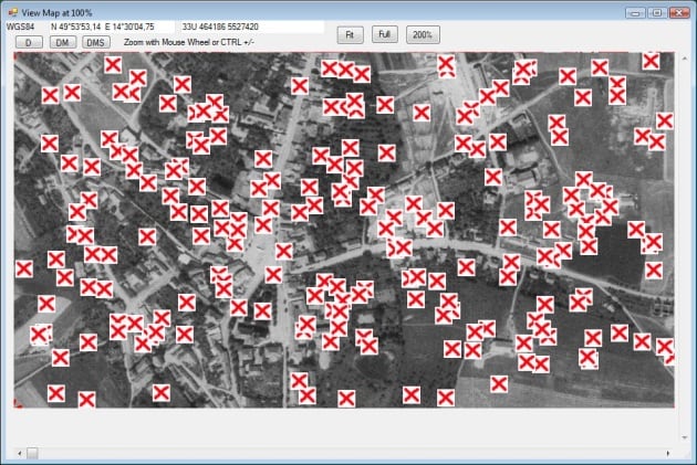
10 GBP is at the current exchange rate some +- 300 CZK. If this is too much for someone, or if they don't want to pay someone via the internet, they can use the freeware program OkMap:
Procedure:
1. Find, download and install OkMap (http://www.okmap.org/en_download.asp), there is also a tutorial.
2.On the website kontaminace.cenia.cz you can find the desired area - I chose the centre of Jílovy u Prahy for the example - out of respect for the hunters.
3. Save the selected cutout via the Export Map button. It will offer you the name of the km without the extension - so change it to the desired name and add the png extension (Jilove.png).
4. Keep the pages open, we'll need them for calibration in a moment. Run the OkMap program.
5. Select File - New - Raster map from the menu. A classic browse window will open, find our image - Jilove.png
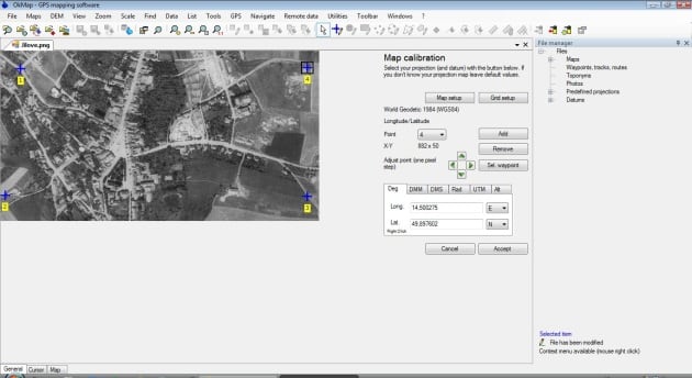
6. The image will load and the calibration window will appear at the same time. To make the output look like something, it wants at least 4 points as close to the corners of the image as possible. The more points, the better the calibration.
7. I chose 4 points (something a bit distinctive that can be found on the original map). Then it's easy - I set the calibration point in OkMap to the desired location, go to the contamination pages, click on the same location and the coordinate window will show WGS coordinates of that location, copy to clipboard, click on OkMap, paste the coordinate and watch out - don't forget to overwrite the decimal point with a comma (if you have CZ wokna).
8. When I have enough points, I click Accept and the image appears as calibrated. File - Save map.
9. The next step is to convert the acquired map to a format that Locus understands - in this case it is the KMZ format.
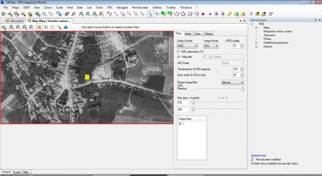
10. In the Utilities menu I select Map tiling / Garmin custom maps.
11. A new window opens, in the upper left corner I open the saved Jilove.okm file and save it as KMZ (via the Generate button - pyramid on the right).
12.
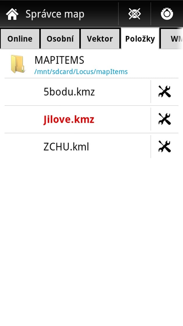
If I am satisfied with it, I upload it to my mobile phone to the Locus\mapItems directory. I can turn on the map from the Maps - Items tab.
Map calibration in OkMap:
Export map to KMZ:
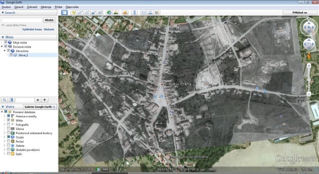
Test in Google Earth:
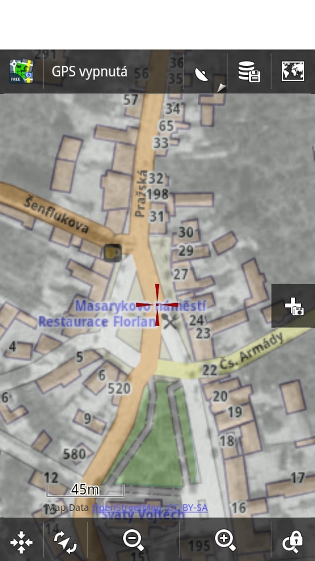
Turning on the map in Locus and displaying it:
What to do at the end?
I'm using a Sony XPERIA NeoV phone, which is, let's say, a mid-range phone. I only use GPS via satellites (and I have verified that it's free) and the accuracy of targeting in the field is about 3-5 m, in the forest depending on the situation, but often you can get within 10 m. I think this is more than enough to find the place again.
I am not a promoter of any of the above programs and am in no way affiliated with their providers. It's just my advice for someone who might have thought of making something similar, or doesn't want to lug another device.
The programs and data used are in the public domain, so I believe that as long as you do not use the above methods for commercial activity, but only for your own use, you are not committing a breach of the license terms. So everything is free and legal.
Mivl
And while you have the map on your phone, don't forget your metal detector at home.
The article is included in categories:
Post
Pěkná práce já to taky kdysi zkoušel,ale vzdal jsem to po tomhle článku to možná zas zkusím.
Zkoušel někdo GPS Logger? Je to podstatně levnější řešení, jak kupovat GPS. Článek jsem nečetl, ale je to nejčastější chyba, takže na to raděju upozorním - podle mého odhadu 90 % mobilů nemá klasickou GPS, ale tzv. GPS-A - tedy asistovanou, na jejíž provoz potřebujete ještě internet. Pokud tedy nemáte připojení k internetu, GPS nepoběží. Další otázkou je citlivost...proto se mi jako mnohem lepší řešení zdá Logger, který mohu připojit k jakémukoliv mobilu s bluetooth, je citlivější, levnější, šetří baterii. Protože na kvalitní GPS prostě nemám a logger stojí kolem 1000 - takže - máte někdo zkušenost? 
To petr_Czech1: tak myslím, že tady je dost velký posun a většina těch dnes prodávaných naopak má GPS. U všeho co jsme testovali se na satelity čekalo jako u klasické GPS.
A teď ten logger: nechal jsem si ho poslat před minulými vánocemi. Mám ho tedy již více rok. Testoval jsem ho asi měsíc a mám k tomuto zařízení opravdu hodně výhrad a určitě bych ho nikomu nemohl doporučit. Ta hlavní je, že přístroj velice často ztrácel příjem signálu a stačilo mu k tomu dostat se mezi domy. Což je u přístroje který byl vymyšlený na to aby se "opilec" dostal domů dost blbý. Obecně, cena odpovídá kvalitě a zlatá navigace na telefonu. 
děkuju za reakci - jinak taky o GPS přemýšlím, konečně jsem si přečetl článek a je to zmíněno, co jsem říkal, ale i přes to - při koupi telefonu trvejte na tom, že jde o klasikou GPS, nikoliv A-GPS (A = asistovaná, na provoz potřebuje internet, jak jsem zjistil o víkendovém testu tak na bratrově smartphonu naprosto nepoužiletná) - čili opravdu co se týče GPS, tak zde zřejmě levnější řešení neexistuje, nicméně mnohé ze zde popsaného se hodí i pro práci offline, tímto tedy autorovi mnohokrát děkuji! 
To Petr Cze: A-GPS se da v mobilu vypnout, slouzi jen pro rychlejsi fixaci satelitu. Viz zde: http://navigovat.mobilmania.cz/clanky/poradek-ve-zkratkach-co-znamena-a-gps/sc-3-a-1314495
A jinak jsem taky drive laboroval s offline mapami do mobilu, Trekbudy, Vlk gps atd.... Ale je to moc prace:-) Pak jsem si koupil obyc turistickej Garmin a bylo po problemu.
Dobrá práce 

Já osobně natahuji mapy do turistiké navigace od Garmina a jede to úplně bez problémů!
Ja si frčím na PDA ASUS prg. OziExplorer 2, mám tam stiahnutú vojenskú mapu z 1985 a som s ňou celkom spokojný . 
Hezkej návod !
Jen mi nějak není jasné, když na té cenii při tvormě výřezu dám zoom 1:300, to už je tam rozumně něco vidět, tak to bude strašně malej výřez ca. 1kmx2km, kdyby to šlo alespoň tak 10x10 km.
Nebo dělám něco špatně? 
... nebo kdyby tam v tom okamapu šlo poskládat vícero těch výřezů.


tak po kontrole v googleearth jsem skončil v Jemenu. 

JEDNODUCHY NAVOD JAK DOSTAT SVOJI MAPU DO Google Earth TAM ZAMERIT A ULOZIT DO NAVIGACE JE TO HOTOVE CCA 1MIN.
http://mojemapy.garmin.cz/
Účelem této stránky je velmi jednoduchým způsobem vysvětlit způsob a postup dohrání vlastních map na displej kompatibilních GPS navigací značky Garmin.
Asi jsem úplný.... kdyz to nechápu podle toho návodu... ale nechápu kde vemu ty mapy a kam je do toho programu mám dát??? aby se mi zobrazila v tom programu... a mohl udělat ten výřez najde se někdo kdo mi to vysvětlí???? 


Tak to já se dostál dál. Vzal jsem výřez, přejmenoval a mám v programu.Chci udělat ty body, ale není popsáno jak. Tak zmáčknu new georef point udělám jeden bod a konec. Dál popis také není úplně jasný.
Tak sem na ty body přišel. musí se zmáčknout Add, ale stejně nevím co dál.


